One of the important scientific directions at the Department of “Surveying and Geodesy” of the Abylkas Saginov Technical University is the inspection of dams and reservoirs using digital laser equipment. The development of this scientific direction in our department was due to the breakthrough of the dam in the village of Kokpekty, which occurred in March 2014. Considering that the majority of dams in the Karaganda region were built in the 50-60 years of the last century, the scientific activity of the department began to develop in the direction of marine geodesy, a new methodology for determining the geometric parameters of both bulk structures and reservoirs was developed. For example, research works by the faculty of the department at the Sherubai reservoir has been conducted for more than 10 years.
The main purpose of the research is to conduct multifactorial scientific research of water management structures with an assessment of safety and substantiation of reliability of bulk structures, timely identification of problems and adverse processes, ensuring improvement of operating modes of structures, assessing the level of safety and risk of accidents, studying the impact of economic activities and infrastructures of water management and hydraulic structures on the environment, developing measures to neutralize negative factors.
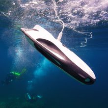
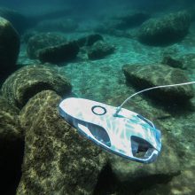
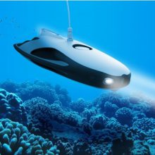
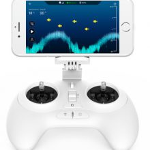
In 2024, under grant funding, young scientists of the department, doctoral students N. Nizametdinov, D. Ozhigin, A. Satbergenova, R. Baigali, U. Kubaidulina, V. Yartseva are implementing a project on the topic: “Development of methodological approaches for monitoring the condition of critically important hydraulic infrastructure facilities in Kazakhstan using unmanned aerial vehicles and remote sensing of the Earth”. Studies of the reservoir are carried out with the help of the acquired unique underwater drone “PowerRay Explorer”, which promises a revolution in the field of marine geodesy. The drone model is specially designed for high-precision measurements at great depths, where traditional methods of working with geodetic instruments are impossible. This project is important both for geodesy and for ecology, as it minimizes the impact on the marine environment. In the coming years, it is expected that the drone will be actively used for various scientific research and environmental protection.
The underwater drone “PowerRay Explorer” makes it possible to automate the processes of mapping the seabed, as well as surveying difficult and hard-to-reach areas under water. It is equipped with sensors that allow to accurately measure depths, determine topography and even track changes in the structure of the seabed over time.
Today, the use of drones in various sectors of the economy occupies a leading position and has superiority over ground surveys. The scientists of the department have significant experience in carrying out research in this area, as well as on other contractual topics based on remote control, laser scanning and digital modeling. According to the results of the research, they publish articles in rating journals (O. Bessimbayeva, E. Khmyrova, F. Nizametdinov), have patents and copyright certificates.
Scientific potential represented by the department (S. Olenyuk, R. Khannanov) has the opportunity to modernize the “PowerRay Explorer” model to solve various scientific and practical problems in difficult underwater conditions, with navigation elements using GNSS equipment, develop special software for specific conditions, make geodetic surveys of dam building structures using unmanned aerial vehicles (M. Igemberlina, E. Oleinikova, M. Tutanova). And there is confidence that all these tasks will be successfully completed.
